

Map
The live fleet map — reading a marker, the layers and hotspot controls, the asset panel, and the things the map deliberately does not do.
The map is what Yipii IoT opens on, and where most people stay. It answers one question faster than anything else in the product: where is it right now?
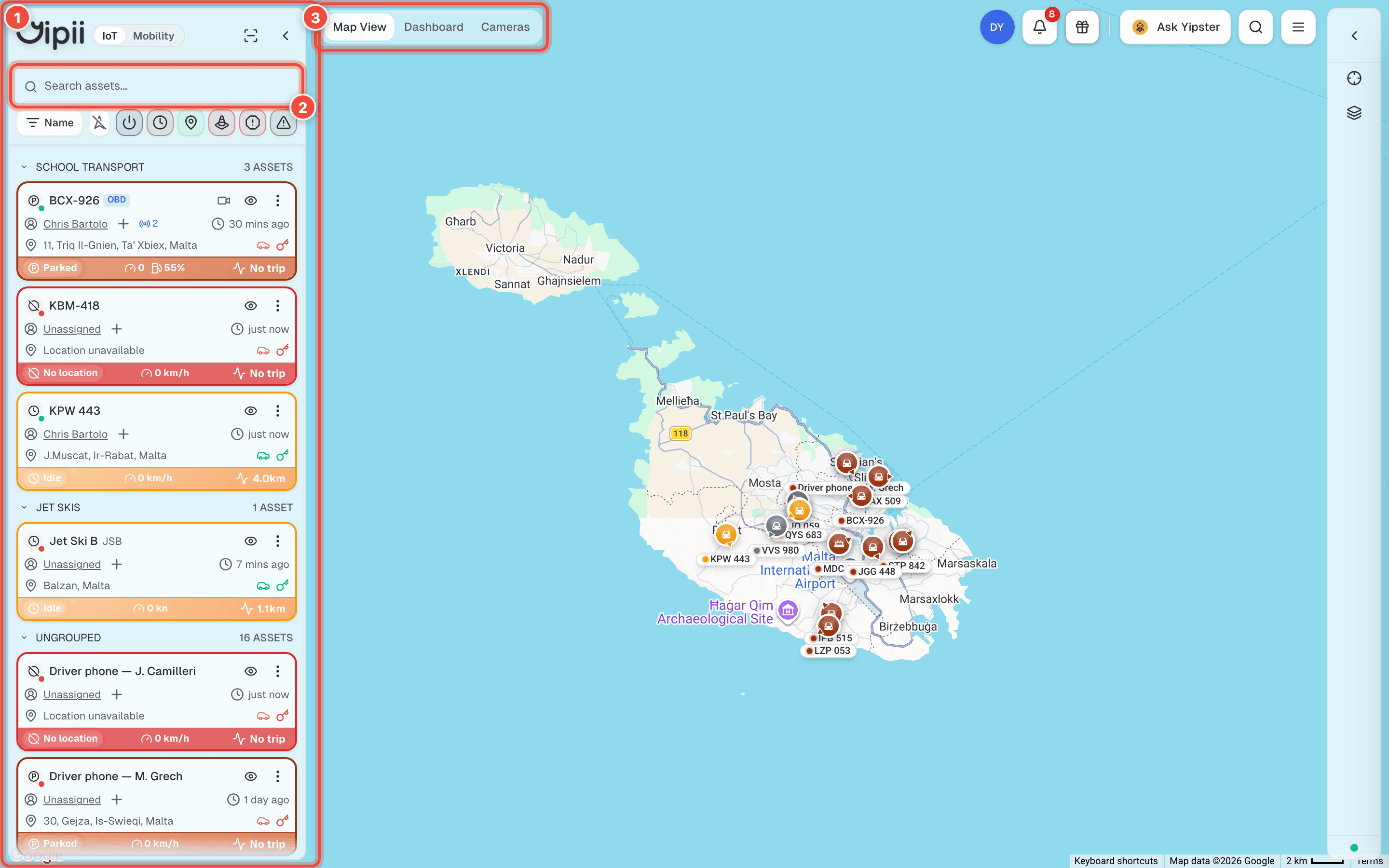
- Asset panel — every asset you can see, grouped and coloured by status. Click a card to focus the map on it; the three-dot menu holds per-asset actions.
- Search and filters — find by name or nickname, or narrow the list to Moving, Stopped, Power Issues, Issues, In Traffic or Fault Codes.
- View switcher — Map View, Dashboard, Cameras. Everything else opens as an extra tab alongside these, from the menu at the top right.
Reading a marker
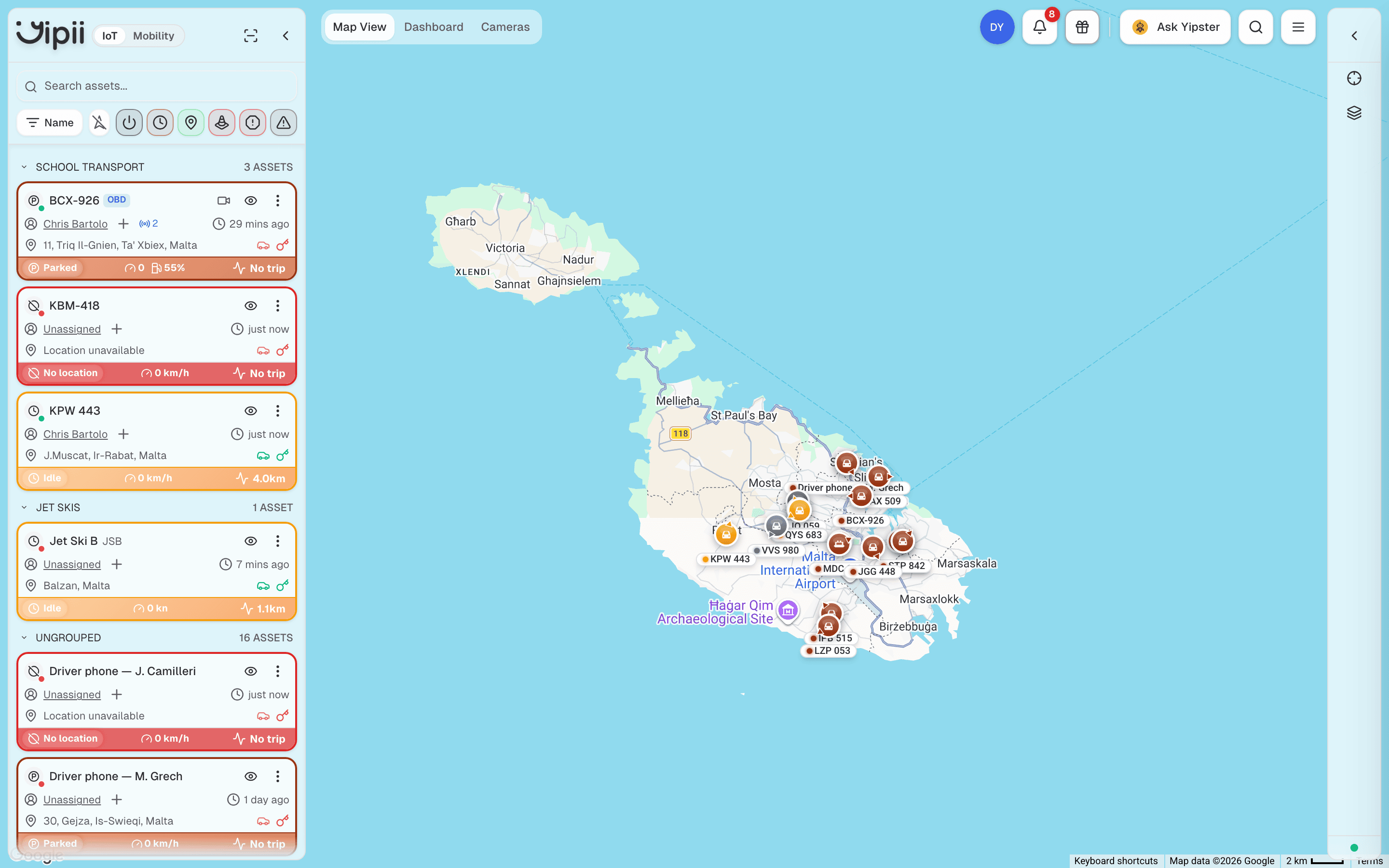
A marker carries two pieces of information at once, and they come from different places:
- Colour is the status — green moving, amber idle, orange parked, red no location.
- Shape and size are the asset type. A bus draws larger than a car, a jet ski draws as a jet ski.
Markers rotate to the vehicle's heading, so a line of green arrows tells you the direction of a convoy without opening anything.
A marker showing the wrong icon is an asset-type problem, not a map problem. Fix the type and the marker changes immediately.
The marker popup
Click a marker for the address, status, speed, the time of the last position, and ignition, GPS and voltage indicators. The driver dropdown assigns a driver without leaving the map, and View Details opens the full asset panel.
Controls
| Control | What it does |
|---|---|
Center map (or press C) | Zooms out to fit every asset on screen |
| Map layers & style | Roadmap or Satellite, plus the hotspot overlays below |
| Scroll / pinch | Zoom. Double-click zooms to a point |
Hotspots
Three overlays, all under Map layers & style:
| Overlay | Shows |
|---|---|
| Idle Hotspots | Where vehicles sit with the engine running |
| Traffic Hotspots | Where the fleet repeatedly gets held up |
| Visited Hotspots | Where the fleet actually spends its time |
Idle Hotspots is the one that pays for itself. A cluster over a customer's yard is a loading problem you can take to that customer with evidence; a cluster over your own depot is a process problem.
Hotspots are built from history, not live positions. They will not change while you watch them, and they need a few days of data before the clusters mean anything.
The asset panel
Sort with Name, Status, Last Moved or Nearest.
Nearest sorts by distance from you and is the fastest way to answer "who can get there first". Last Moved puts stale assets at one end, which is how you find a tracker that has quietly stopped reporting.
On a phone the panel collapses to a narrow rail and the view switcher becomes a single button labelled with the current view.
What the map does not do
- It is not history. The map is now. For where a vehicle went, run a trail or trip report.
- It does not draw geofences by itself. Geofences live behind the Alerts screen.
- It does not alert. Watching the map is not monitoring — that is what alerts are for.
If it doesn't work
| Symptom | Cause | Fix |
|---|---|---|
| An asset is in the list but not on the map | It has no position yet, or no tracker | Check its status. No location means connected without a GPS fix |
| The map is empty | A status filter is still applied from earlier | Clear the filters above the asset list |
| A marker is the wrong shape | The asset type is wrong | Change the type on the asset; the marker follows immediately |
| Positions look frozen | The live connection dropped | Reload the page. If one asset is frozen and the rest are live, it's that tracker |
| Hotspots show nothing | Not enough history yet | They need several days of data |
| A vehicle jumps between two points | Poor GPS in an urban canyon or under cover | Expect it in cities. Persistent cases are usually where the device is mounted |
| The address is wrong but the pin is right | Reverse geocoding on a rural or new road | Trust the pin; the address is a lookup |
Related
- Statuses — what each marker colour means.
- Assets — what each marker shape means.
- Geofences — the shapes alerts and reports key off.
- Reports — for where a vehicle has been, rather than where it is.
Was this page helpful?